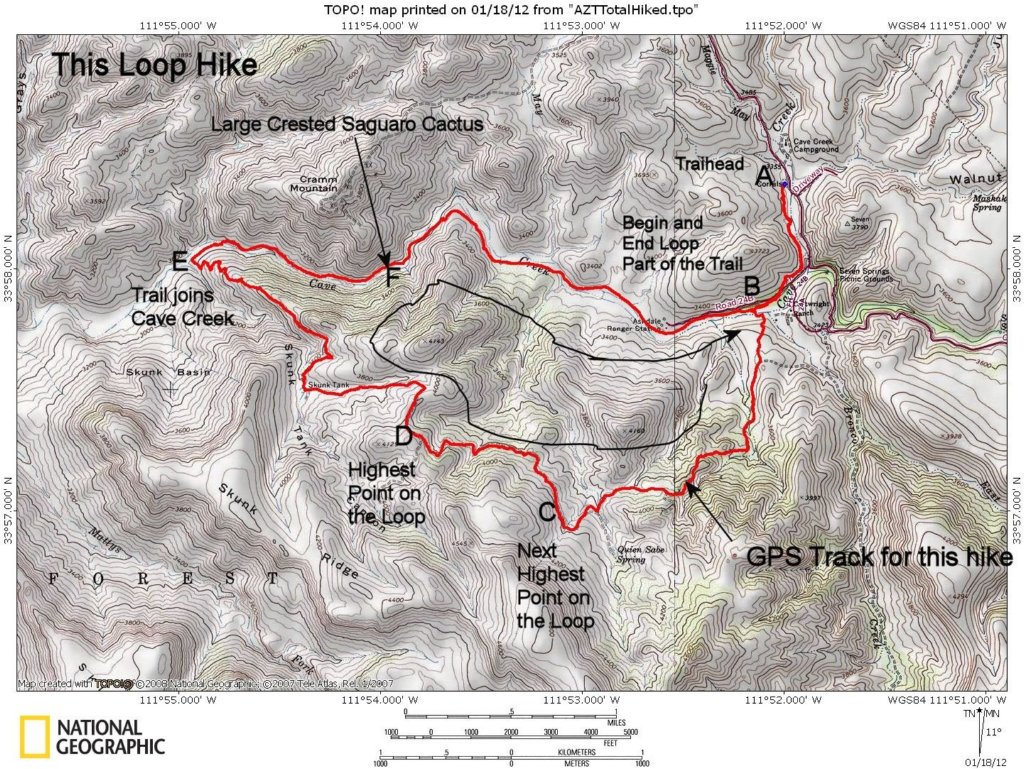

USGS Quad topo with the track for this hike (red line). Black line shows the clockwise direction we took around the loop. The letters (A, B, C, D, E, F) show signficant locations coordinated with the hike profile shown on the next slide.
Photo album created with Web Album Generator