SASCO Smelter Ruins and Old Mines (Feb 27,2018)
Feb 27, 2017; BobF & Don
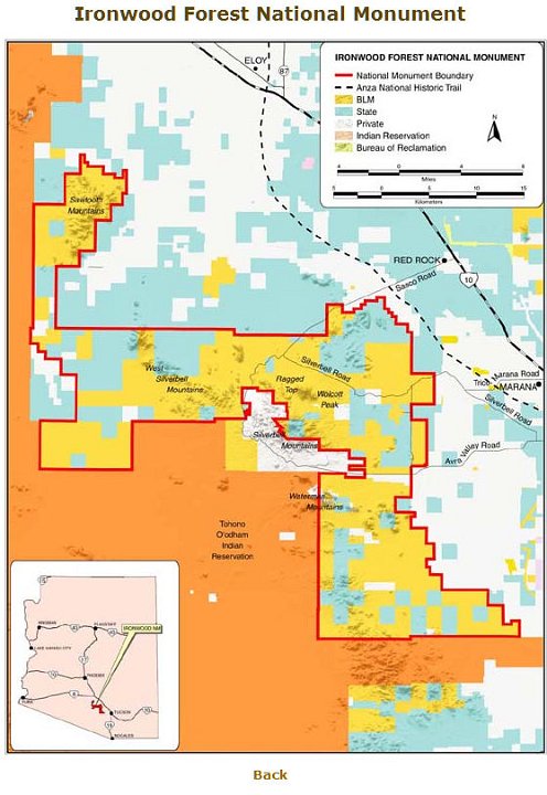 1 The red line is the boundary of the Ironwood Forest National Monument (https://ironwoodforest.org/visit/map-and-directions). It looks like a gerrimandered political district. |
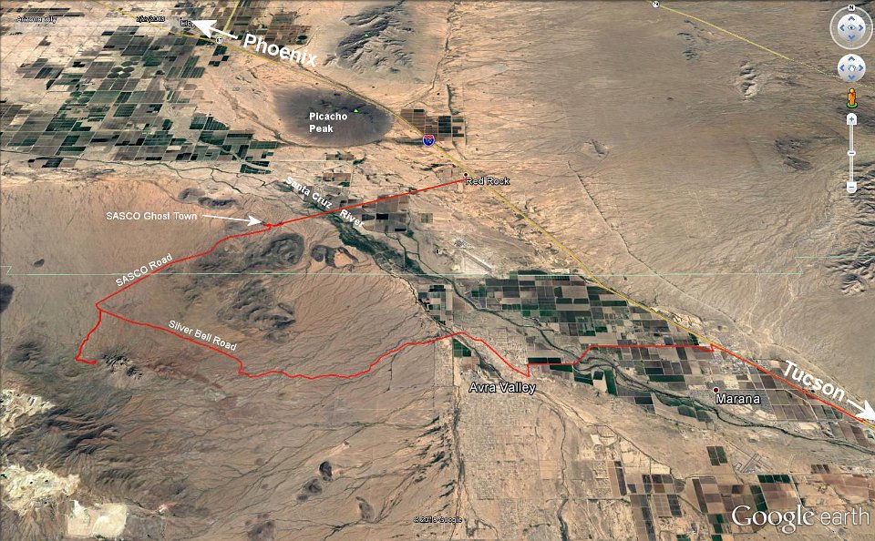 2 Our track through the National Monument. We expected the Santo Cruz to have some flow, but it was dry; so we drove right across. About where SASCO Riad neets Silverbell Road is our track up and back along the 4W road to the mines. |
 3 Just after crossing the Santa Cruz, we pulled off SASCO Road to explore the remains of an old stone building. |
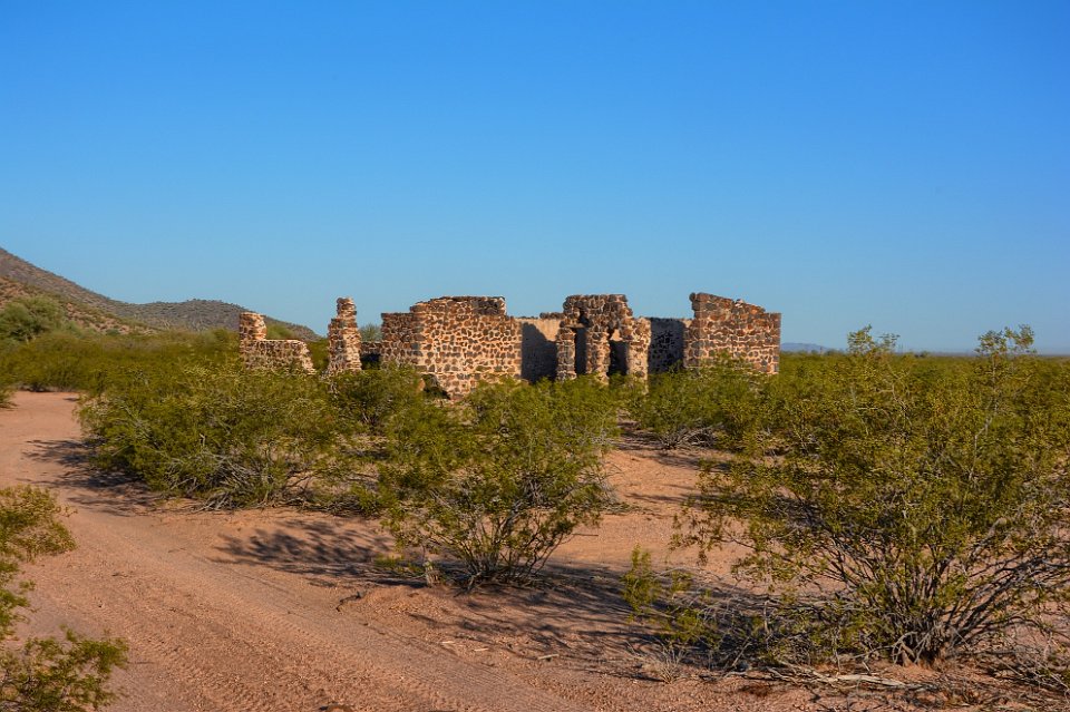 4 OK, what was it? Want to guess? |
 5 The hotel or boarding house for the smelter. So you guessed right. Right? |
 6 |
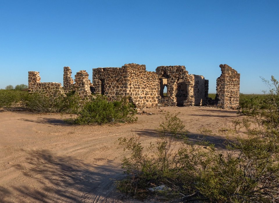
 7 |
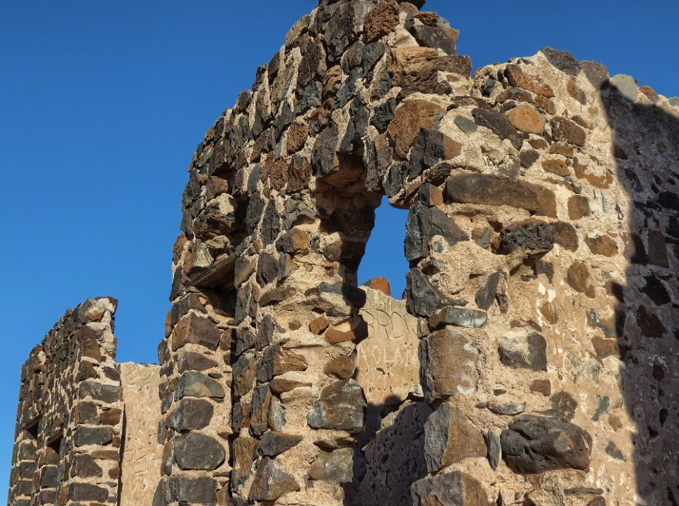 8 One interesting feature was the wooden lintels above the windows. The lintel for the window at the right has deteriorated and collapsed allowing the rocks in the wall above it to begin to collapse. |
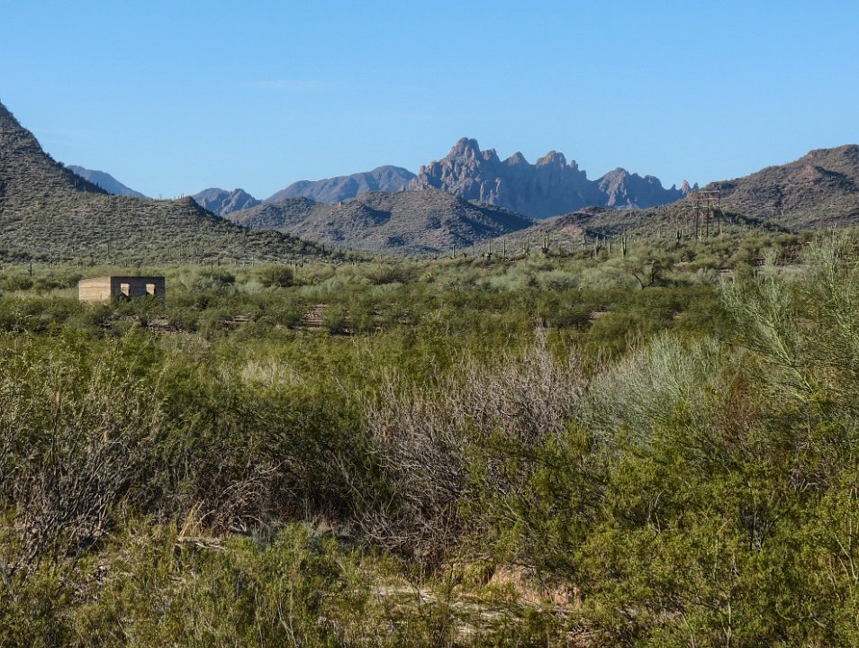
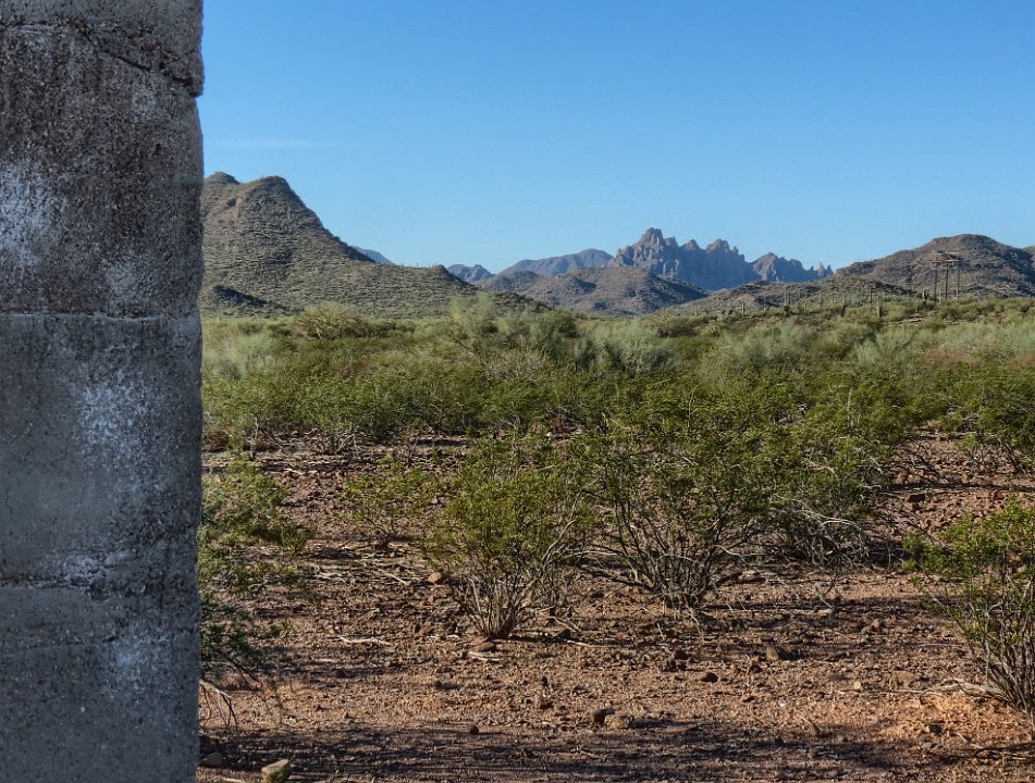
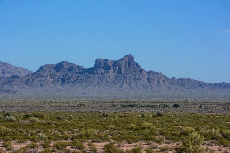
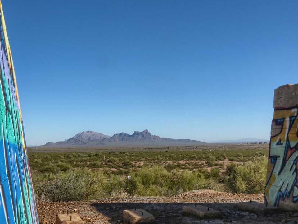
 9 |
 10 Looking to the south we notice an interesting, rugged mountain. Lots of smaller jagged peaks on top. Would be tough climbing this one. The building at the left in also interesting, so we head out, on foot, toward it. |
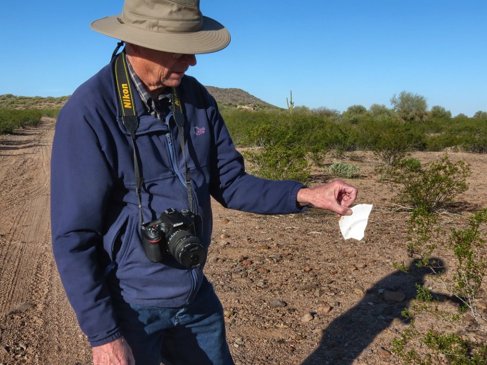
 11 Looking back to the north, Picacho Peak is east to spot. If you've only passed this peak driving on I-10, you have seen the other side. |
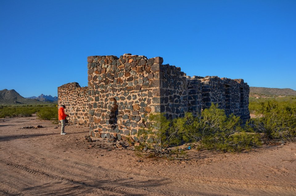
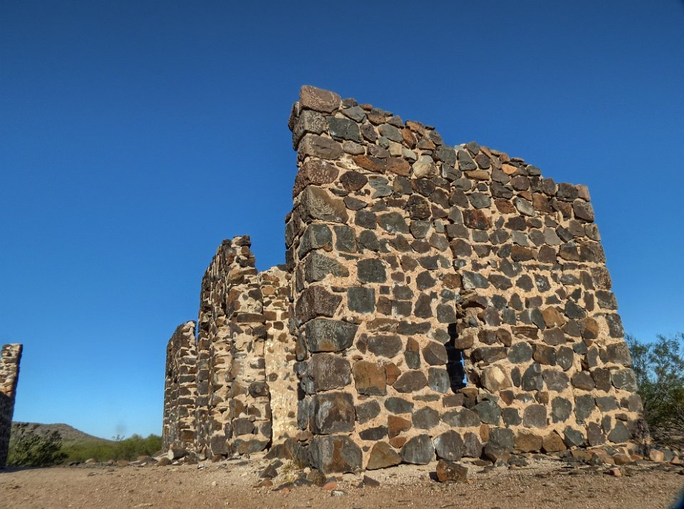
 12 BobF finds a potsherd, but of much later vintage that the potsherds we found up in the Agua Fria National Monument. |
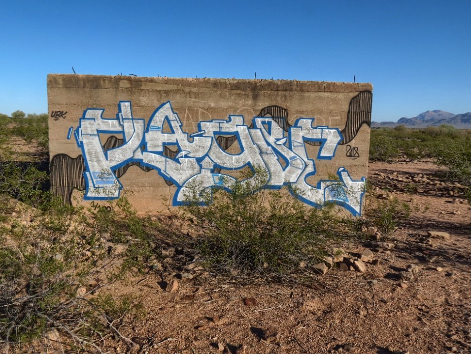
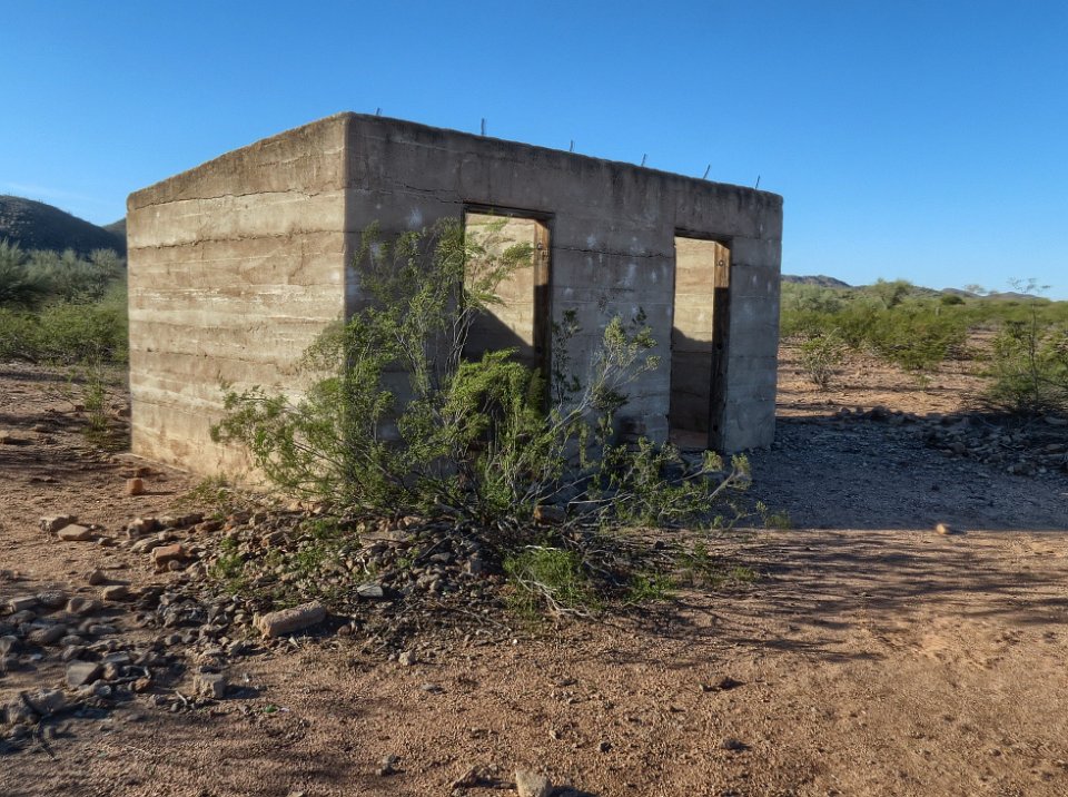 13 Ok, we are now at the building we had spotted. Bob and I later read that this was the jail. I'm guessing that this would be a human cooker in the summer. |
 14 Taggers have been at work on the back of the jail. These may meet the definition of pictographs: dye or paint on rock. But they are certainly not ancient. |
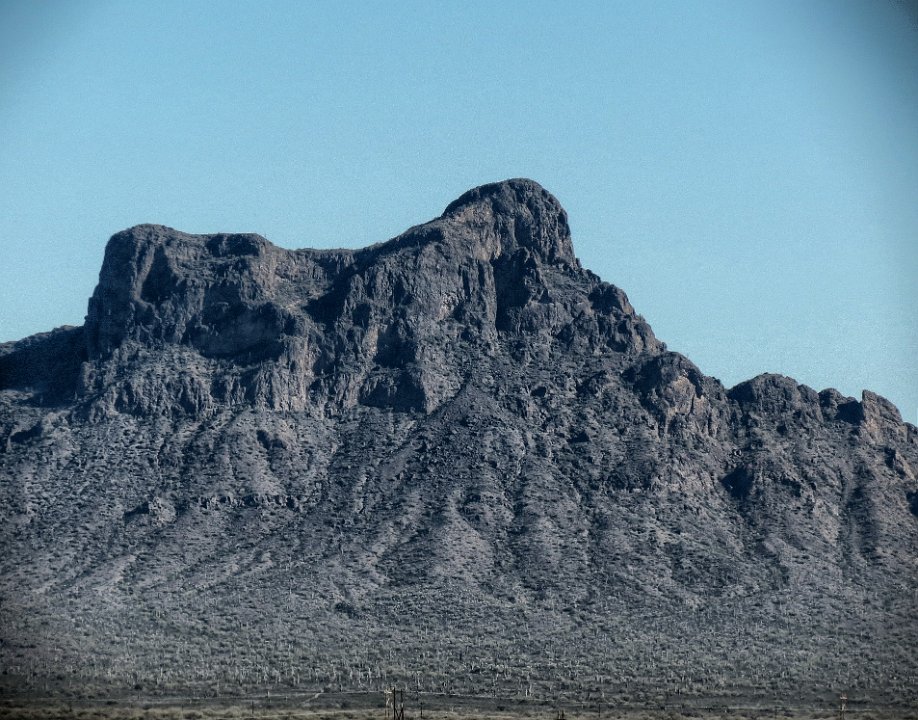
 15 Looking south again toward that interesting peak |
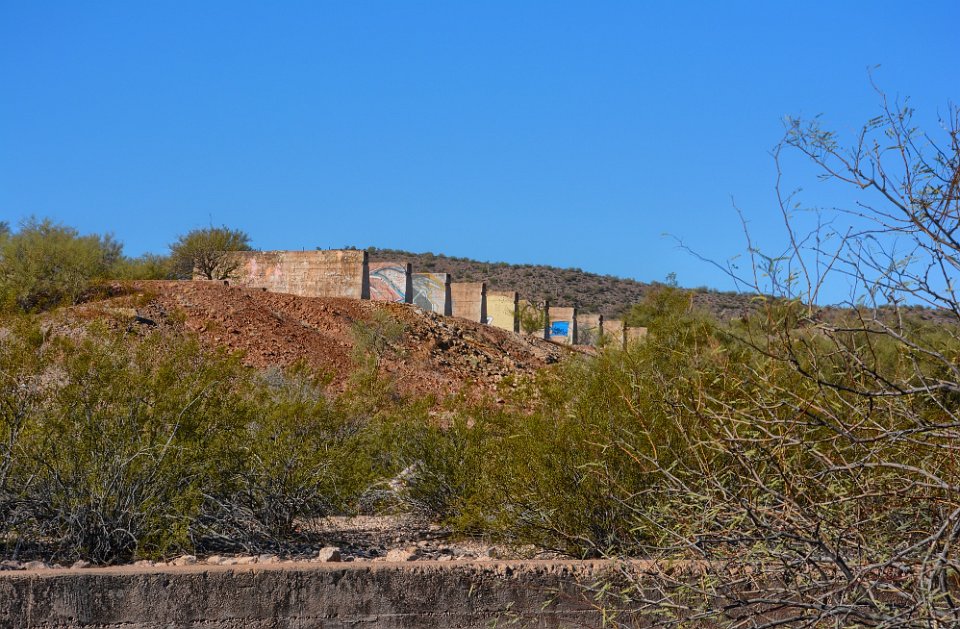
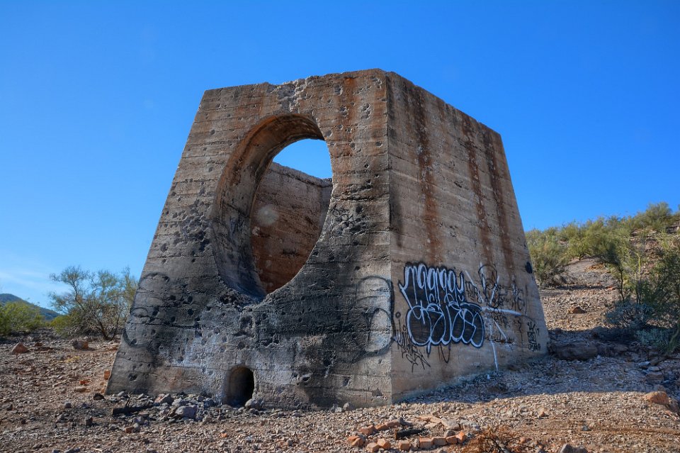
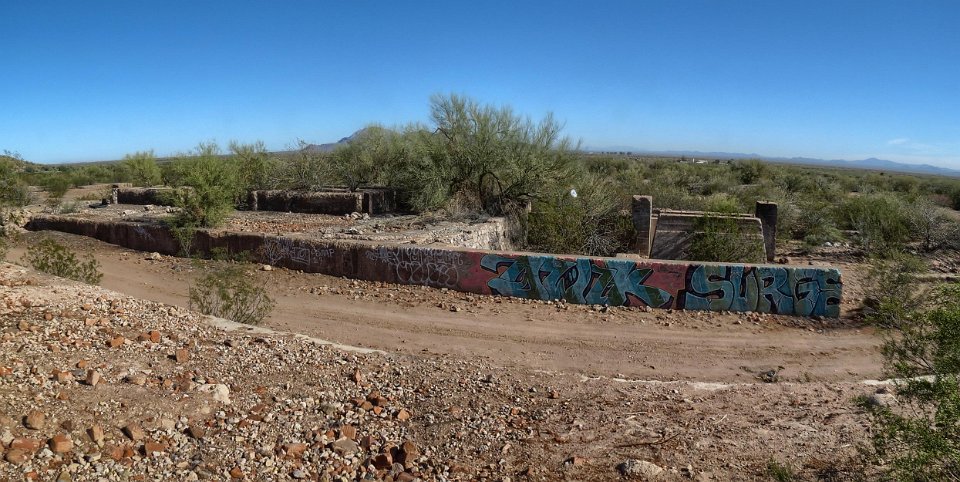
 16 Zooming in some. |
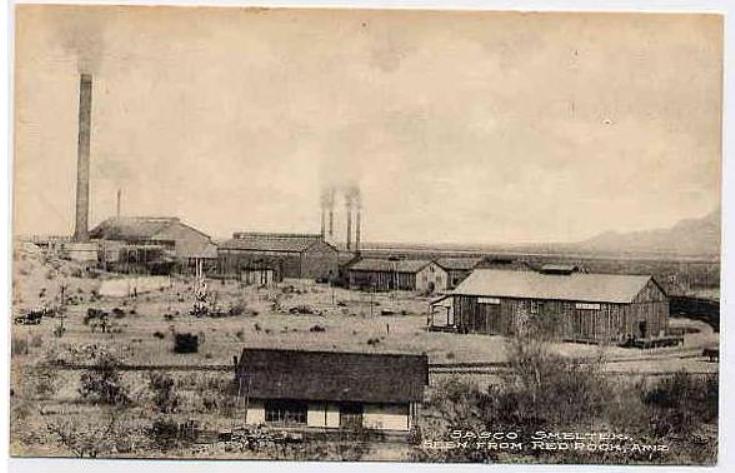
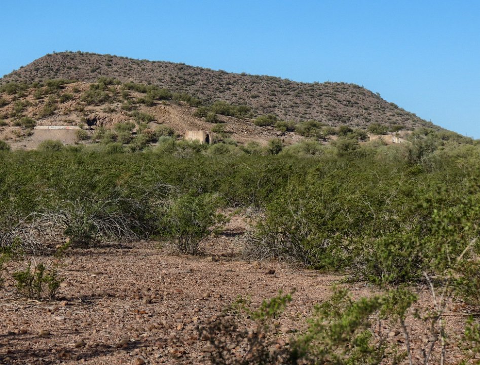 17 A short distance away, we spot some more remains of the smelter. |
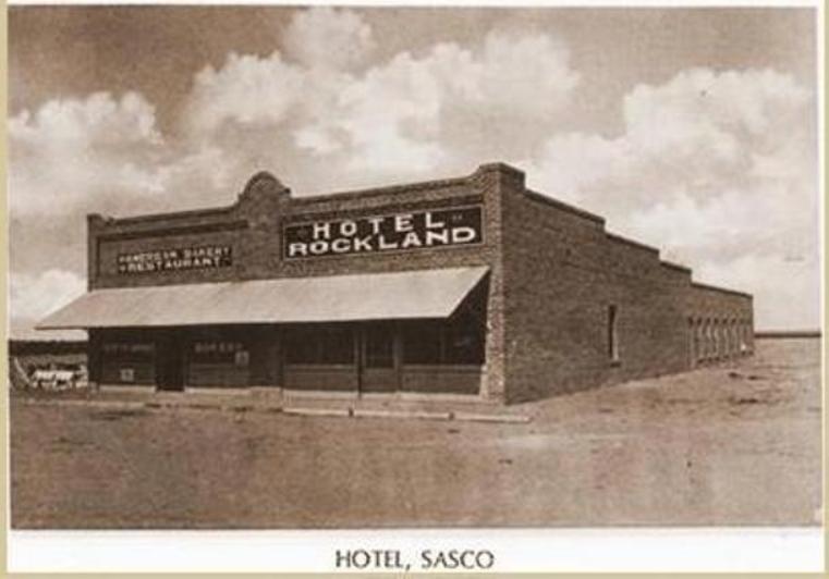
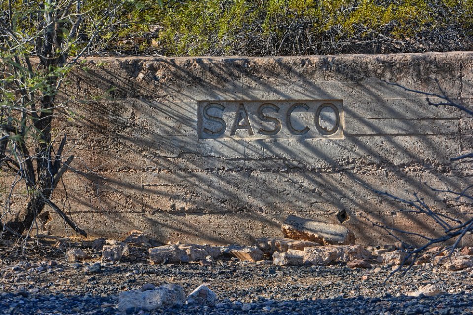
 18 The Southern Arizona Smelting Company or SASCO smelter as it appeared some time in the period of 1907 to 1912, the short time when it operated. It smelted ore from the old Siverbell Mine which is about 12 miles away. Accommpaning the smelter was a town of about 600 people which had a post office, hotel (or boarding house) and a jail, the latter two features were in previous photographs in this photo album. We didn't see any signs of houses, but didn't look that closely. The post office closed in 1919. A railroad between the smelter and the mine brought the ore here for smelting. The large stack in the picture was 175 ft. tall - only the base, or foundation, exists today. |
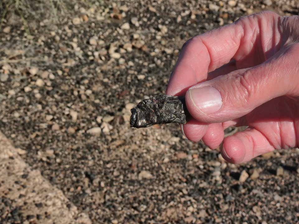
 19 Yep, we are at the place we thought we were: Southern Arizona Smelting COmpany. |
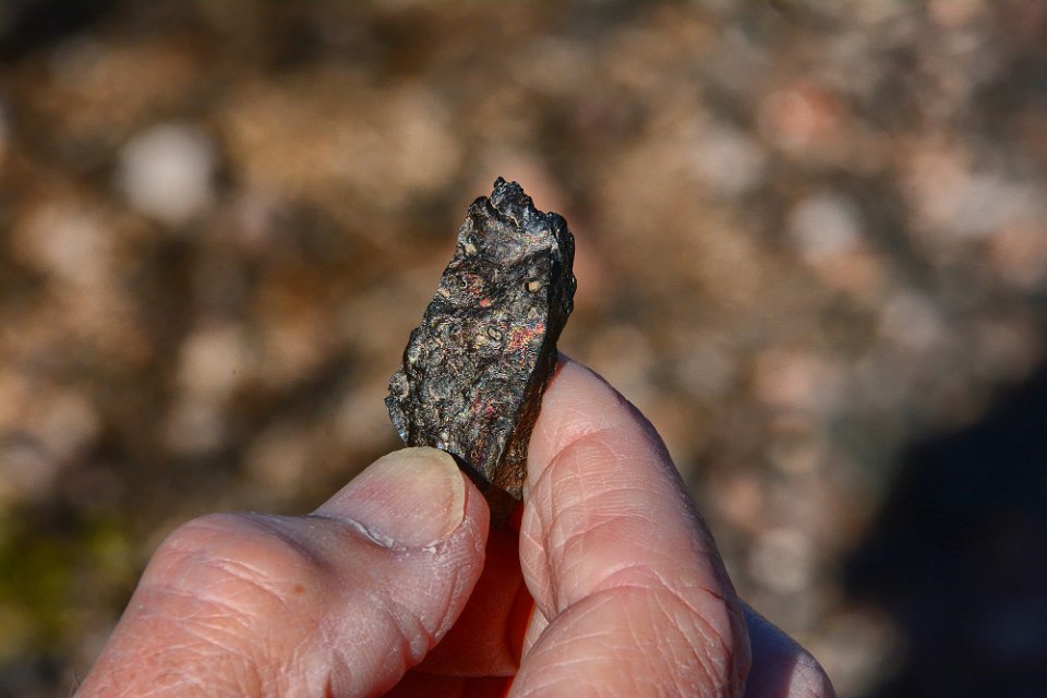
 20 Some slag found in a slag heap. This piece shows some signs of copper in the slag. |
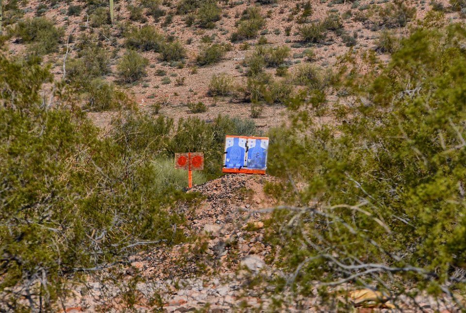
 21 Another piece of slag. The copper is clearly visible. |
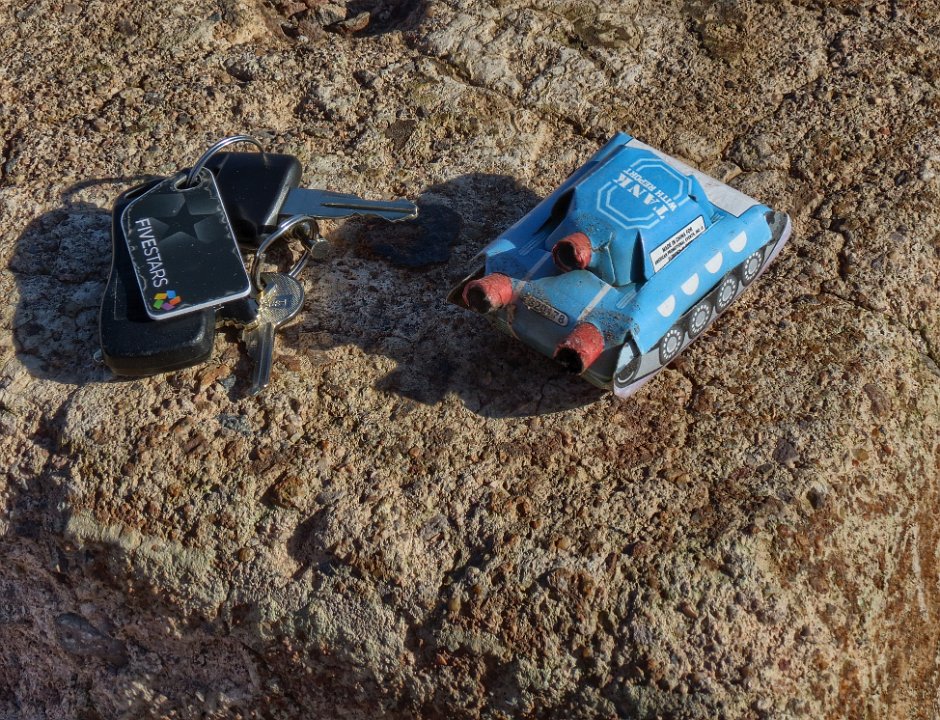
 22 Being on private property, the place is frequently used as a shooting range. Here BobF looks at some shell casings. |
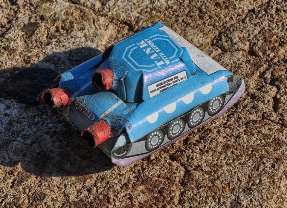 23 OK, the artillery includes even a tank - OK, now we're really pushing the limits of the 2nd amendment. I don't think the Founding Fathers had this in mind................. |
 24 Oh, but it's only a minature tank made for fireworks. |
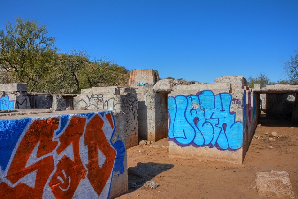
 25 |
 26 Those are interesting. Ore bins? |
 27 Yep, and they were built to support the railway. |
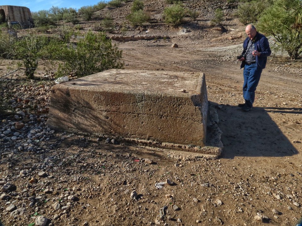
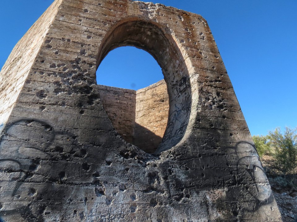
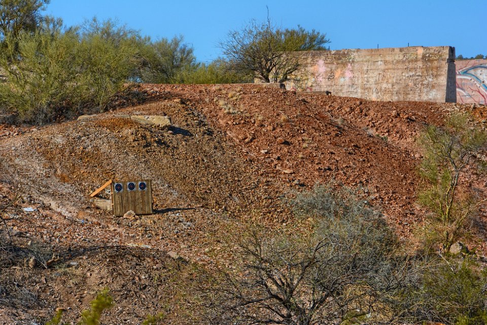 28 Some signs of being a shooting range. |
 29 That's the base of the 175 ft. tall smoke stack. |
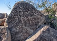
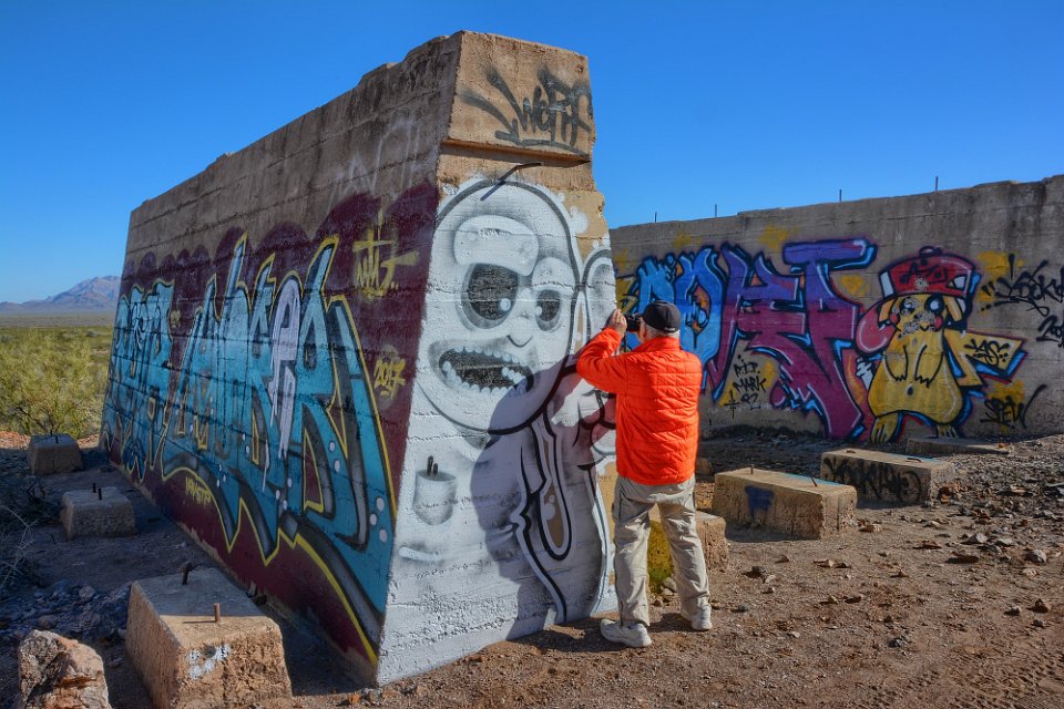
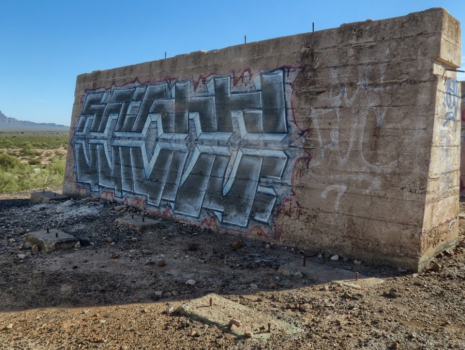
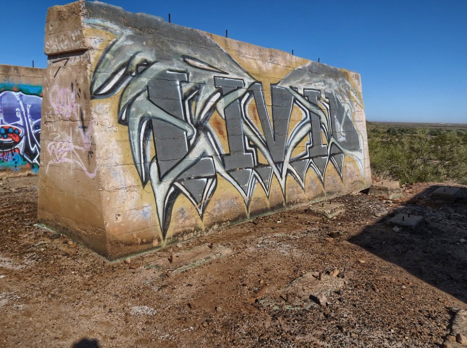
 30 Oops. |
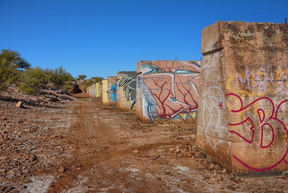 31 The ore bins have been hit by taggers, who have put their pictographs everywhere. |
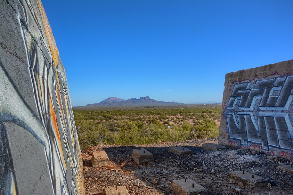 32 Actually, we were impressed with the quality of the pictographs. The creativity, the colors and the quality impressed us. |
 33 Zooming in on Picacho Peak. |
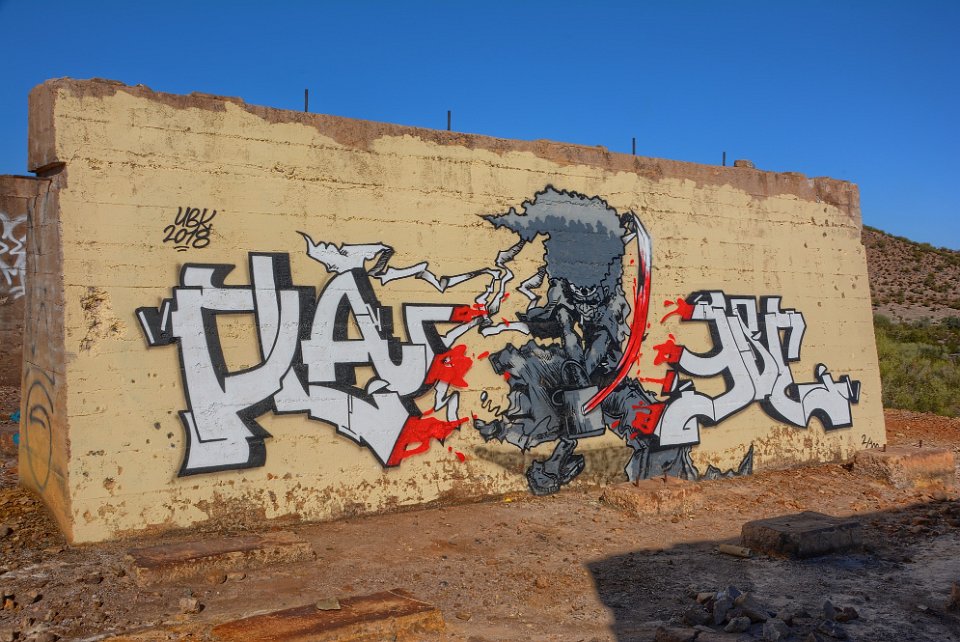 34 The taggers are obviously very talented. |
 35 Don is focussed on taking the previous picture of Picacho, totally unaware of the monster that is about to attack him. But look at the line quality, and the choice and blending of colors. |
 36 |
 37 |
 38 |
 39 |
 40 |
 41 |
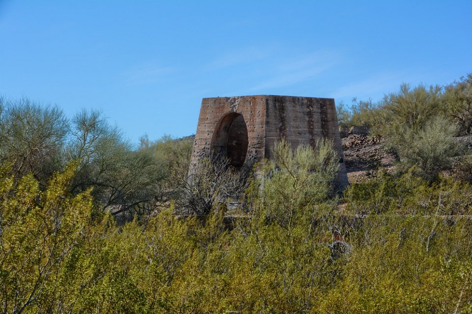
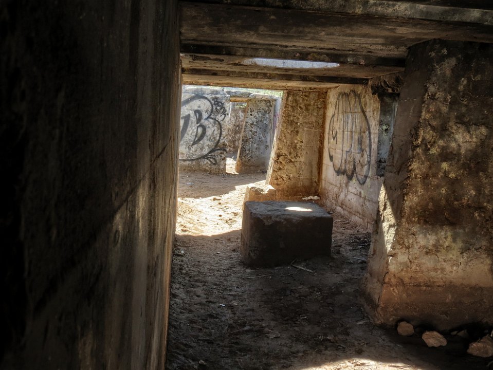
 42 |
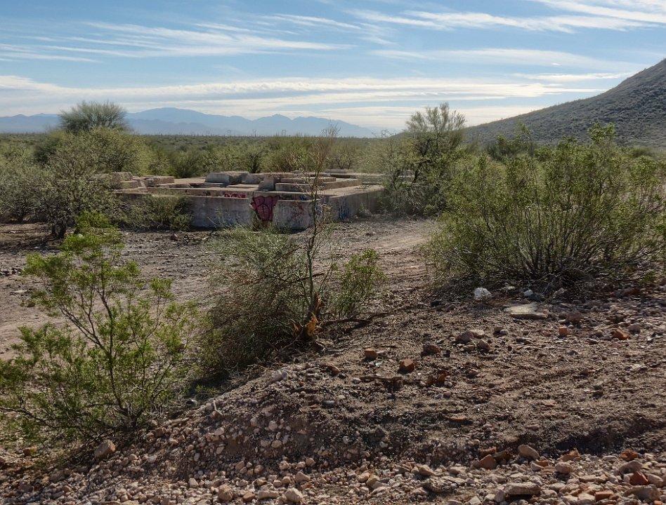 43 Another structure. |
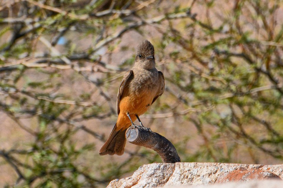
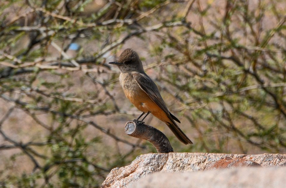
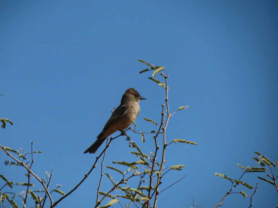
 44 This structure, whatever it was for, had a mase of internal corridors. |
 45 We were "distracted" by this bird that kept flying around in the vicinity. BobF got a great shot. We have confirmation from a "world-class" birder that it is a Say's phoebe, a bird in the tyrant flycatcher family. |
 46 |
 47 |
 48 OK, back to exploring the mase of internal passages. |
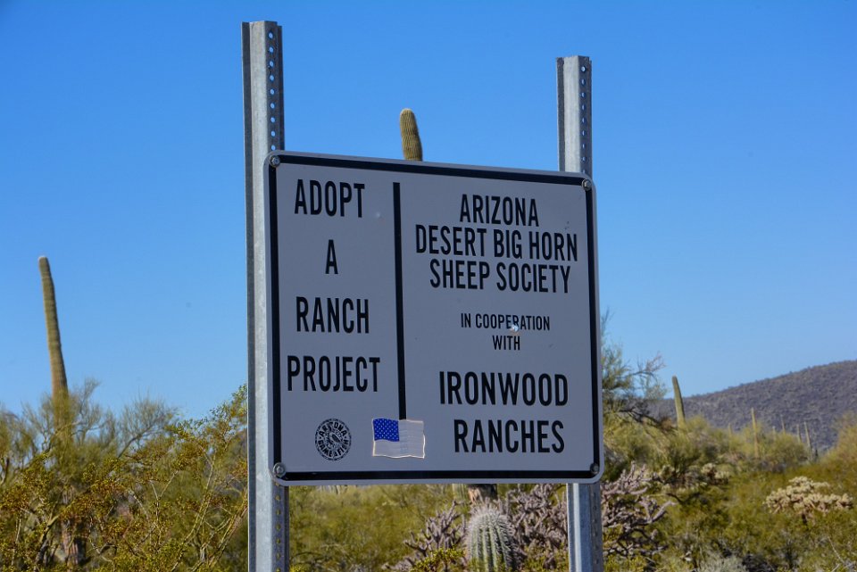
 49 |
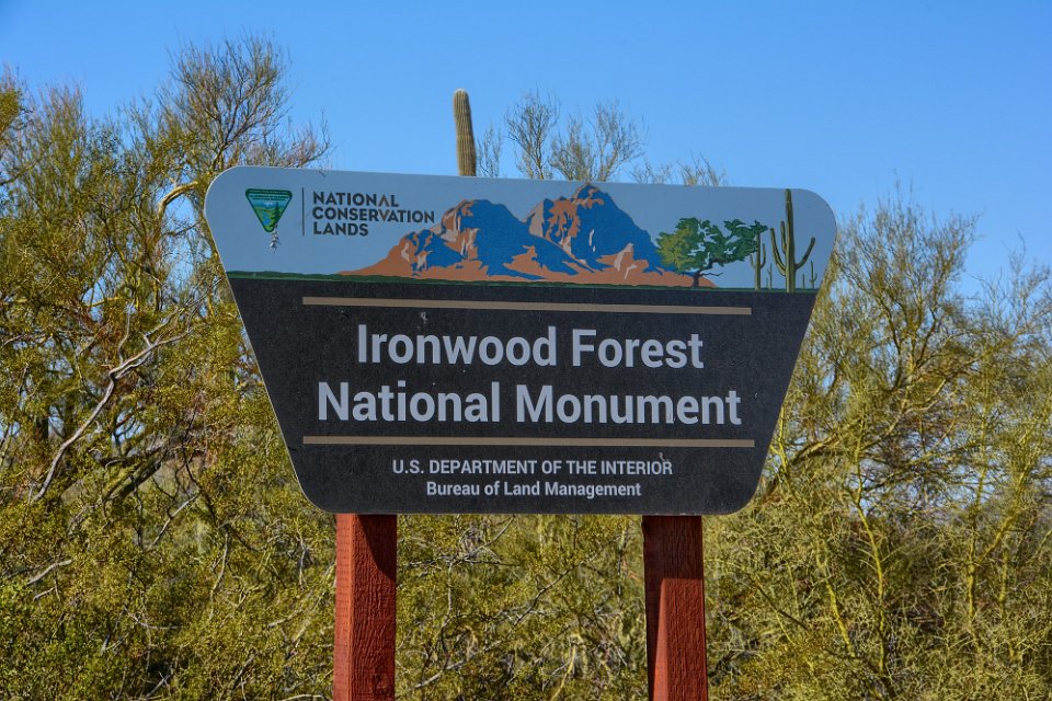 50 After viewing the remains of the SASCO smelter, we continued on down Sasco Road and into the National Monument. |
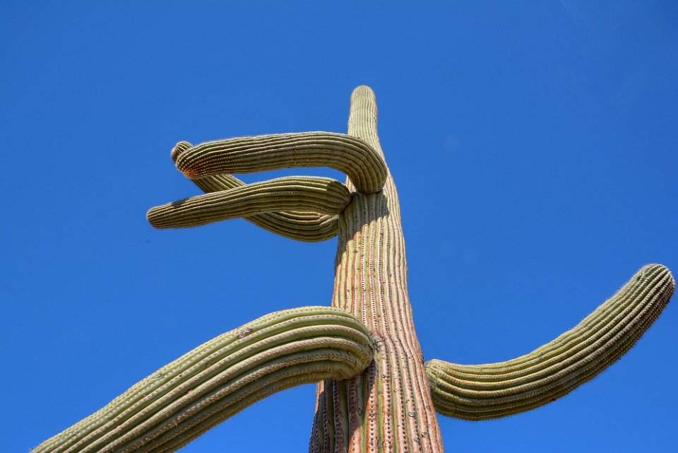
 51 Soon after passing this sign we turned southeast onto Silver Bell Road. |
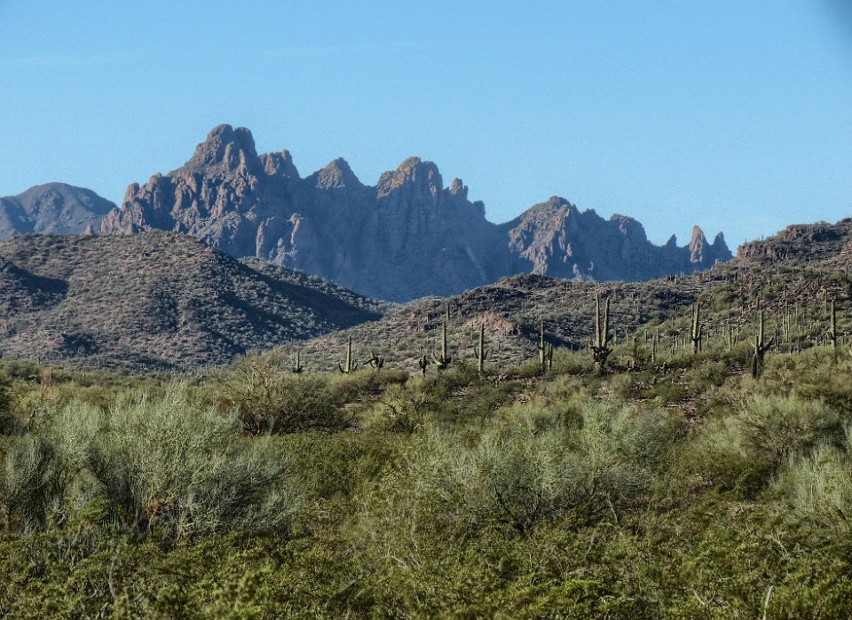
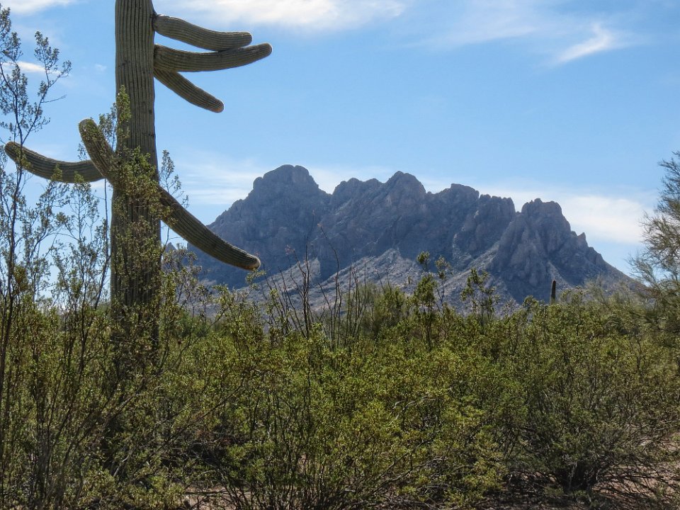
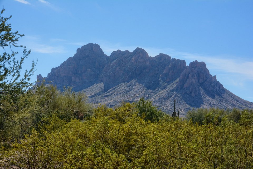
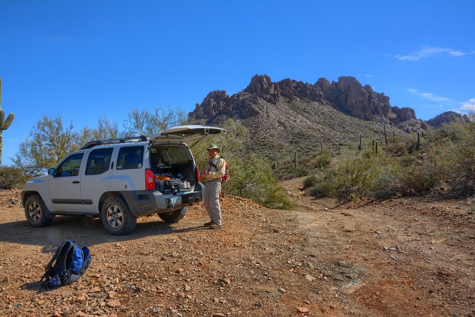
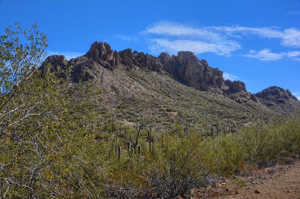
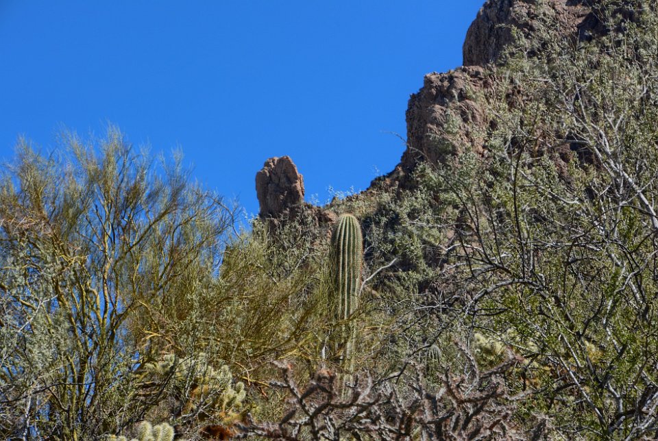
 52 We had to stop because this Saguaro seemed to be telling us something. |
 53 That interesting peak had come much closer and we realized that it was Ragged Top mountain, the mountain icon of the Ironwood Forest National Monument. We also realized that the hiking track that Don had found went up and over this mountain. OK, is there another place we can hike? This is not for two "mature" men. This is not the place we want to die. |
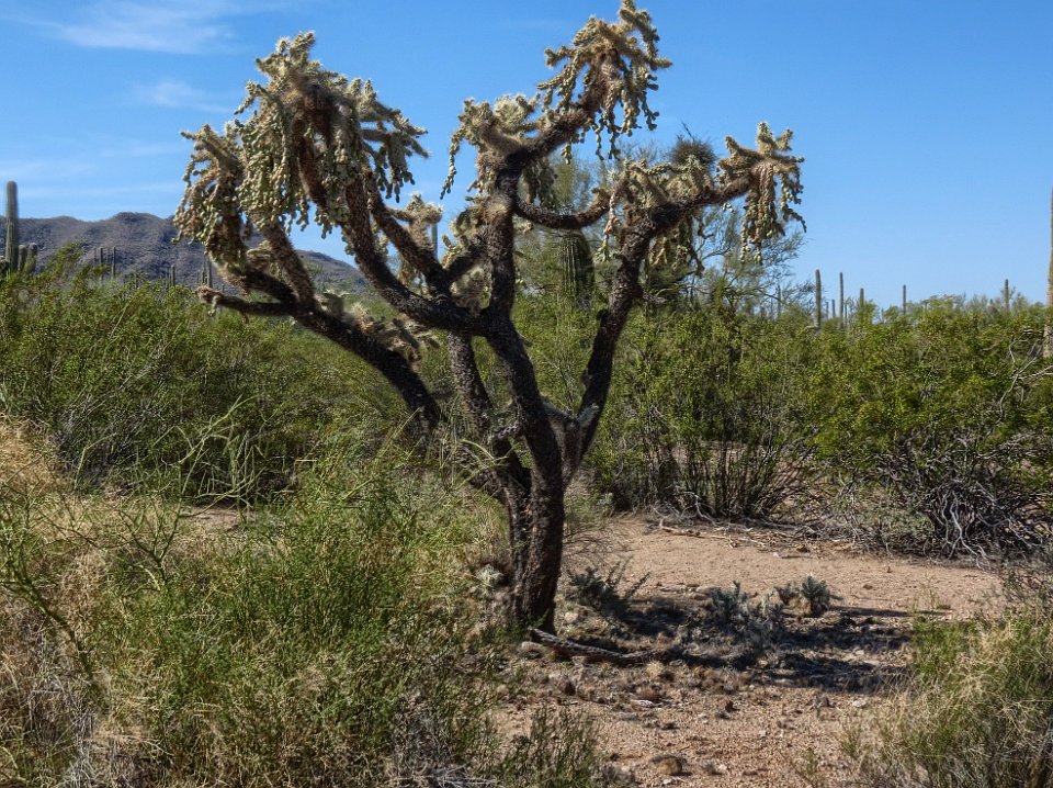
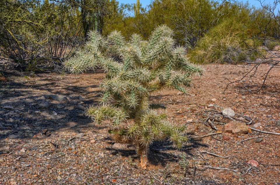
 54 |
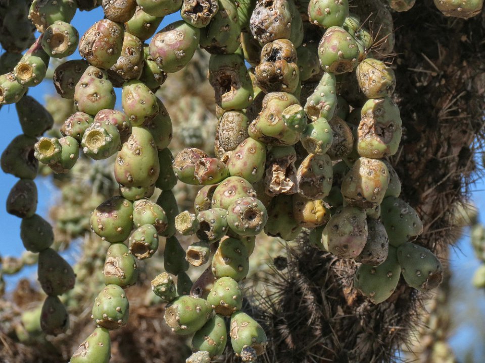
 55 A chain fruit cholla cactus. |
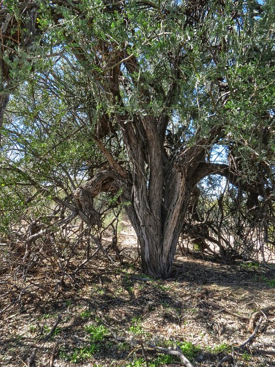
 56 The "chain fruit" of the chain fruit cactus. |
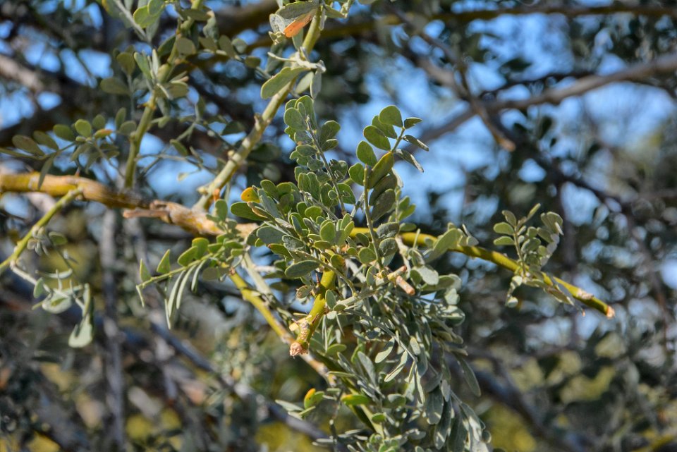
 57 Ironically, we spot an Ironwood Tree in Ironwood Tree National Monument. What a coincidence ;-). These trees have veeeery hard and dense wood, and live for 80 to 100 years. The Australian variety (the Australian Buloke) of this tree has the hardest wood in the world - over 5,000 lbf on the Janka scale. Desert Ironwood (Olneya tesota) has a 3,000 lbf Janka hardness. The Janka scale measures the force required to embed an 11.28 millimetres (0.444 in) diameter steel ball halfway into a sample of wood. It is commonly used to determine if a wood is suitable for wood flooring. For density comparisons, 12 % moisture content Desert Ironwood has a specific gravity of about 1, compared to most 12% moisture content Oaks at between 0.6 and 0.7 . |
 58 The leaves of the Ironwood Tree. |
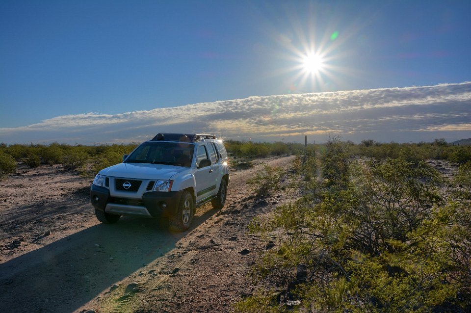
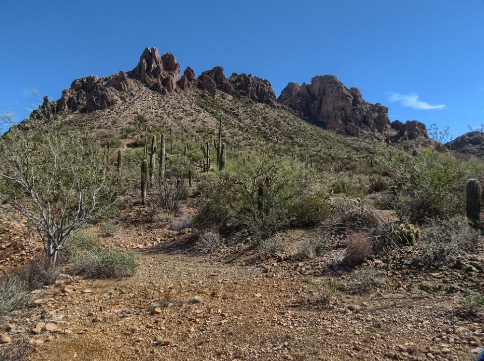
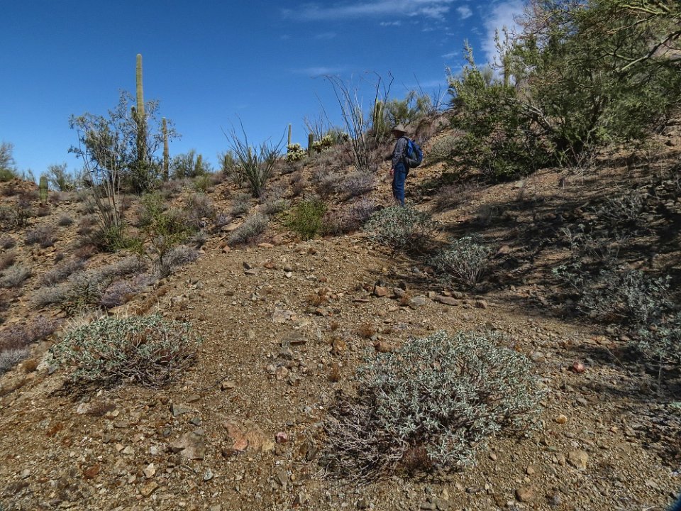
 59 A cholla cactus. |
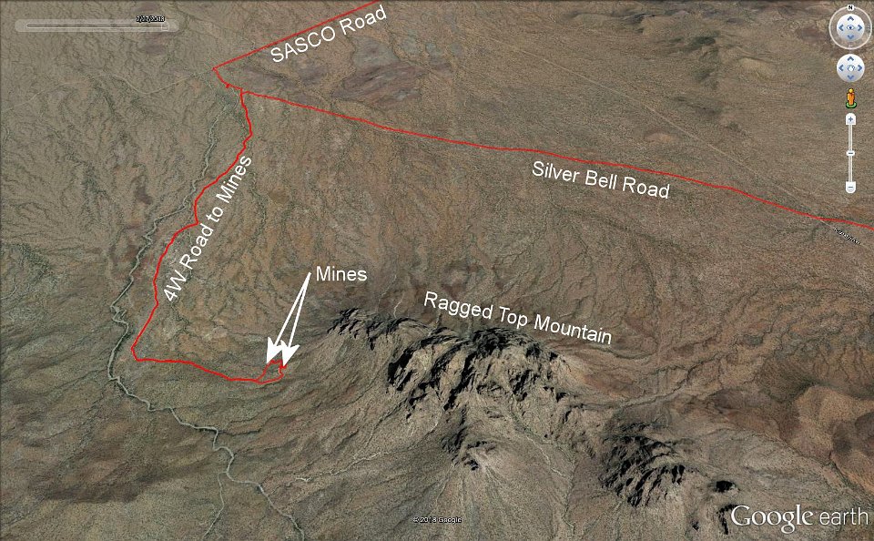 60 We take a 4W road to as close to two old mines as we can drive and then hike the rest of the way. |
 61 The road extended another 1/4 to 1/2 mile to a locked gate, but that short stretch looked much rougher. Besides it was time to stretch the legs. So we hiked the mile to 1 1/2 mile to the miles. |
 62 There they are upon the lower slopes on the southwest corner of Ragged Top mountain. |
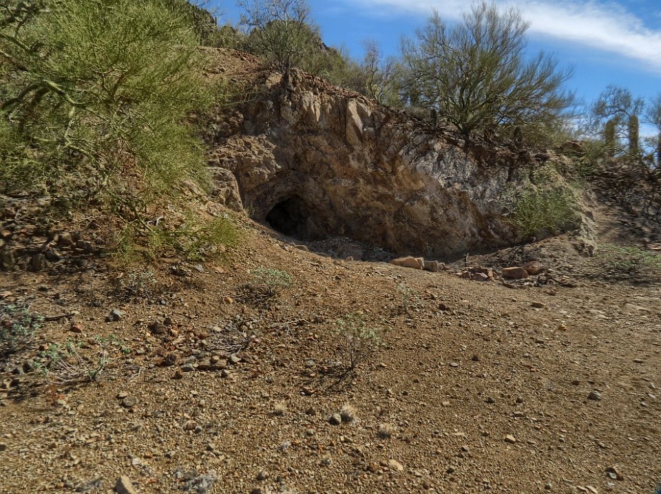
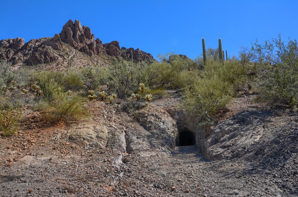
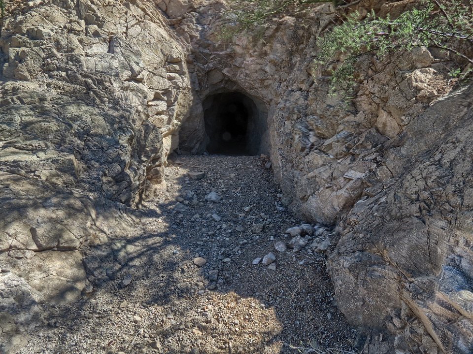
 63 |
 64 We've reached the higher of the two mine adits. |
 65 |
 66 Someone (the BLM?) has blocked entry. |
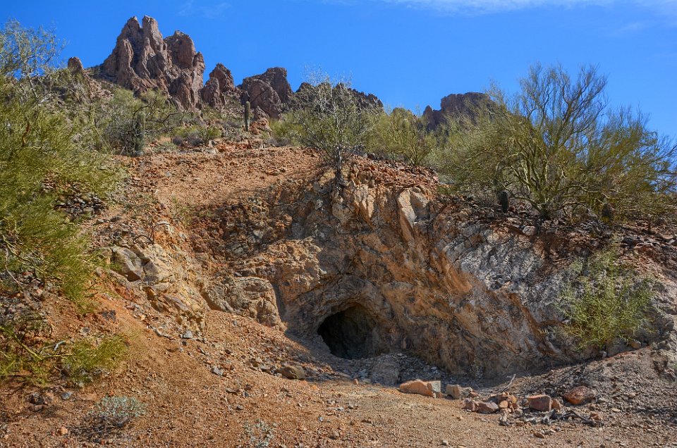
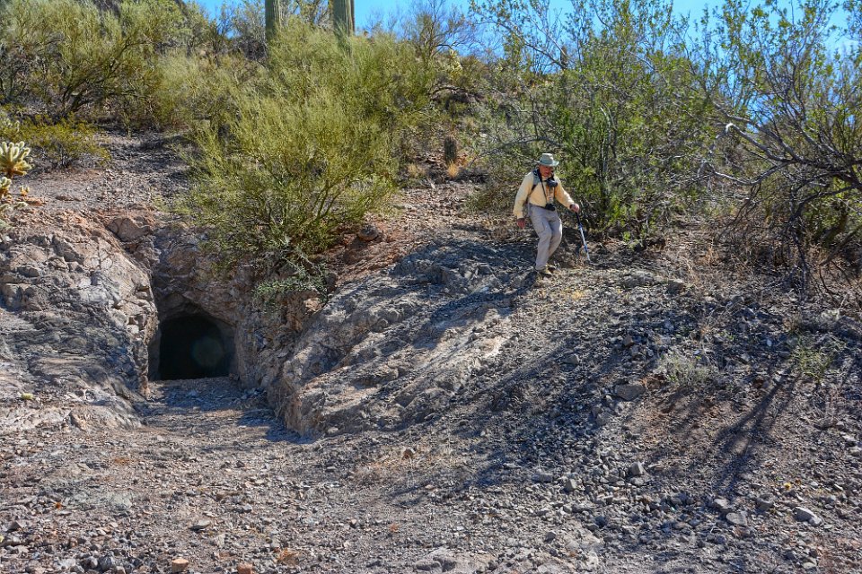
 67 IF you go up the barrier and shoot between the bars, this is what you get. |
 68 We now contemplate how to get down to the lower of the two mine adits. |
 69 Bob has switchbacked the steep slope down. |
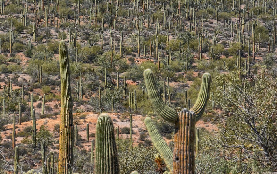
 70 Don follows. |
 71 Looking out over the sea of Saguaros. We didn't see one crested Saguaro all day (turns out we went right by one on the way into the National Monument as we found out in our return visit on March 6th). |
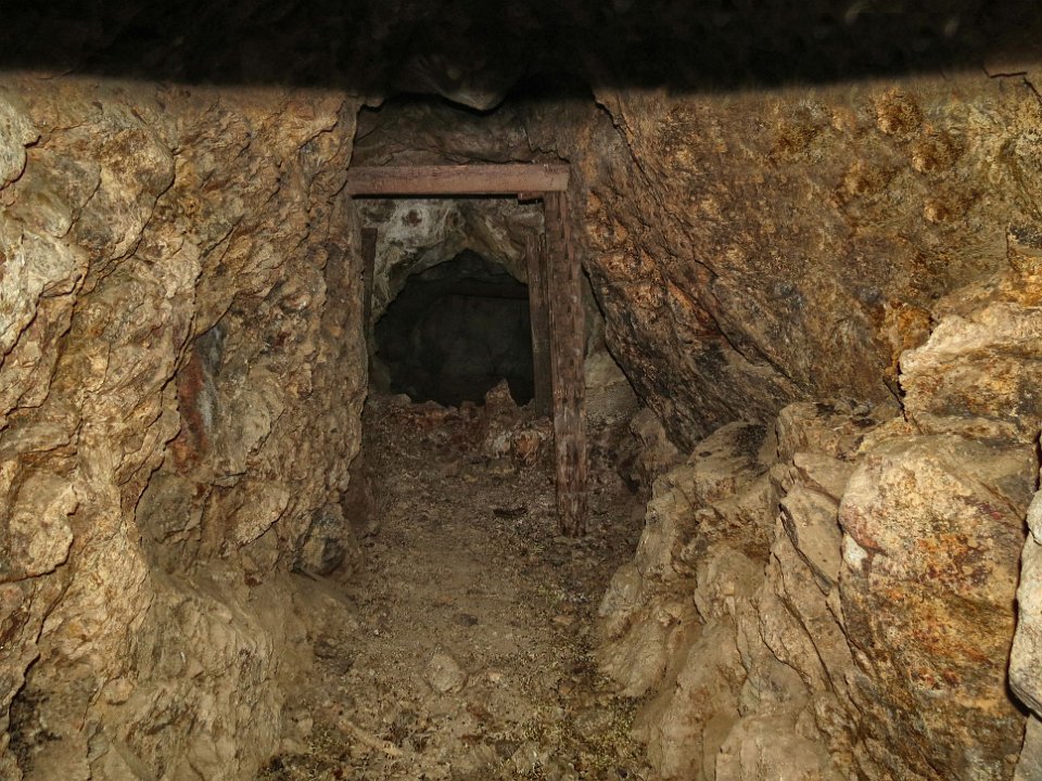
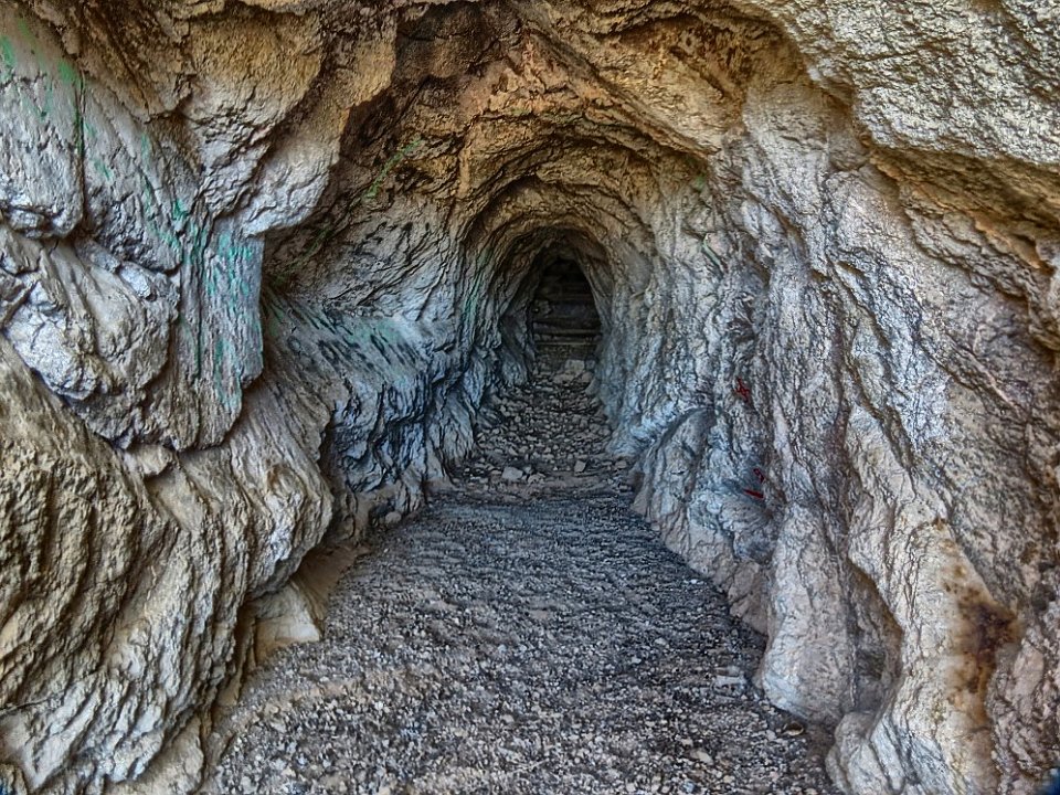
 72 |
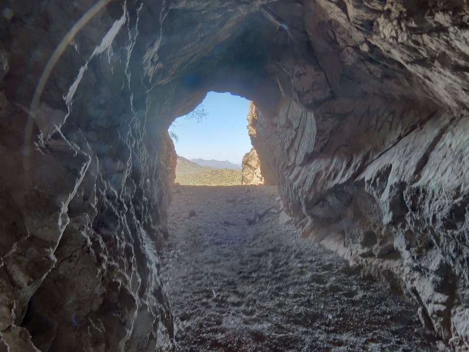
 73 This one is blocked off, also, but further into the tunnel. So..... |
 74 Don went into the tunnel as far as he could and got this shot back out toward the entrance using 6 different exposures and a HDR program to take the best parts of each. |
 75 One last shot up the west edge of Ragged Top Mountain, and we're off to find a place for a late lunch. And wow, did BobF find us a nice place. We feasted on $20 hamburgers. |