| << Previous | Index | Next >> | ||
 |
 |
 |
 |
 |

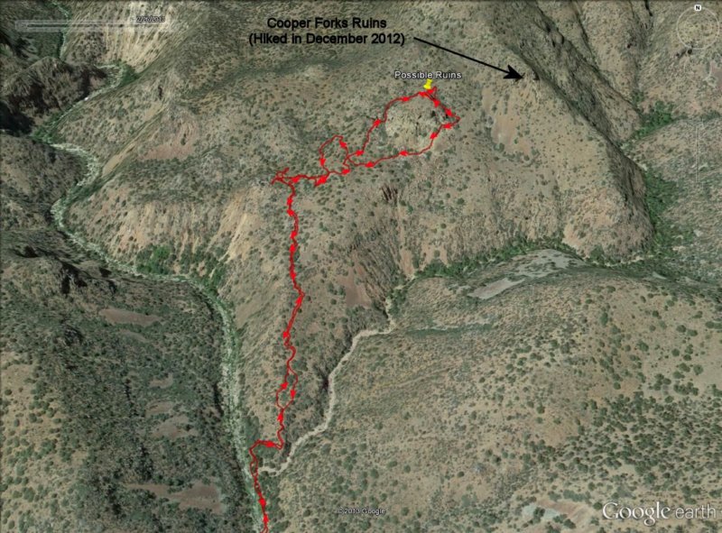
3-D close up of the GPS track (red line) superimposed on a Google aerial photograph showing the climb up the "ridge line" from Cherry Creek to the ruins we were looking for. The black arrow points to the location of the much better known Cooper Forks Canyon cliff dwelling ruins which we had visited back in December of 2012.
Photo album created with Web Album Generator