| << Previous | Index | Next >> | ||
 |
 |
 |
 |
 |

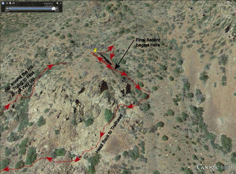
3-D close up of the GPS track (red line) superimposed on a Google aerial photograph showing the hike around the knoll and up to the ruins we were looking for, as well as the descent and start of the hike back to the trailhead and the car.
Photo album created with Web Album Generator